
Author:
Sechelt Inlet
Sechelt Inlets Marine Provincial Park:
An Idyllic 4-day Canoe Trip

Leaving Porpoise Bay
At Piper Point


A harvest moon rising over the mountains


Packing up the TentSechelt Inlet is a fjord with character. The first thing you notice is the backdrop—lush forests and towering mountains. Then, you hear the float planes taking off and landing in Porpoise Bay. As well, houses line the first 5 km on the west side and 10 km along the eastern shore. Looking more closely at the lush forests, it becomes obvious that almost the entire valley has been logged. Most has grown in, though the new growth is obvious, and there are several new clearcuts. You’re likely to see barges move up and down the inlet, ferrying machinery to job sites at the heads of Salmon and Narrows Inlets, two offshoot fjords of the main one. However, compared to Indian Arm in North Vancouver, boat traffic is minimal. We could easily count the number of power craft that we saw in the distance each day, far fewer than what we might see in an hour in Indian Arm. And boat wake was almost non-existent. So, a big part of Sechelt Inlet’s character is the ongoing industry, including three fish farms near Salmon Inlet on the west shore, a handful of oyster farms and an ongoing sea-side logging operation either side of Piper Point.
Active logging
While industry may detract from some feeling of remoteness, the inlet still has a wild feeling. Mountain views are everywhere, and the fishing must be great as seals abound. The bull kelp we often saw must be helping the fish, as young fish hide in its forests. Many other species of marine mammals visit too, though sadly, we did not see any. We did see birds of many species (belted kingfishers, surf scoters, mallards, loons and all manner of ducks and gulls, etc.). As we approached Halfway Beach for a break, the call of the loon broke the stillness.
We did briefly see a marten, a cute and furry weasel-like land animal scurrying along shore. Oyster and clam shells littered the beaches and although they were hidden from view, we know there are ochre sea stars (still recovering from the awful wasting disease that decimated their population) because we saw a sea gull chewing on one. Moon jellies were a constant presence.
Dancing Moon Jellies
As we paddled on our second day, still on glassy water, we passed lovely Arbutus trees, with their smooth reddish bark, lining the cliffs.
Paddling on Glass
Soon we spotted Halfway Beach camp, with its large, gently rising pebble beach lined by Douglas fir trees and views down Salmon Inlet. It also has a creek and a lovely rock outcropping to sunbathe on. Those Doug fir trees are magnificent. You know you’re in the presence of these giants when you find their cones on the ground. Their unique cones have three-pointed bracts sticking out of the scales. (Did you know that Douglas fir trees aren’t true fir trees at all? They are in the pine family and false hemlock genus).
Views from Halfway Beach


Tzoonie Narrows Campsite
The Narrows

Arriving at Tzoonie Narrows Campsite
It is small but cozy and has a grassy field that makes for a lovely place to relax and watch the wildlife just in front of us. We enjoyed watching surf scoters, aquatic birds that gather in large numbers every Fall. The 50 or so in front of us would be calmly paddling along and suddenly get spooked and take off in a panic in a cacophony of flapping wings and caution cries only to land 100 metres away and repeat the process. Thankfully, they quietened down at sunset.
Noisy Surf Scoters
After another peaceful sleep, we rose with the sun, packed up, ate breakfast and headed five kilometres back up the inlet, again on glassy water! As we left, KJ demonstrated a graceful wet entry into the loaded canoe.
A Graceful Wet Entry
At the confluence with Sechelt Inlet, we turned back south towards Porpoise Bay, where we had put in, 25 kilometres away. Just five kilometres in the opposite direction lay Skookumchuck Narrows where the water rushes through at 16 knots. Kayakers play there, but it’s not a place for an open canoe! (We did visit there on another trip and managed to arrive at slack tide.)
We passed a couple of fish farms on the opposite shore and soon came to Salmon Inlet and a campsite at Kunechin Point. This camp is situated just behind some islets, which are home to dozens of seals. It’s is also the site of the former Canadian destroyer HMCS Chaudiere, which was deliberately sunk to serve as an artificial reef for scuba divers. The campsite sits high on a bluff with commanding views south and east. In fair weather, it’s spectacular—not so friendly during a storm, as it is exposed to the wind.
Kunechin Point
For us, it was a welcoming spot to have lunch and nap before setting out for our final camp, Nine Mile Beach. However, rocky beaches present a problem at lunch. A fully-loaded canoe is too heavy to carry, unloading it takes time, and dragging it on the rocks would damage it. Our solution is to roll it out of and back into the water on logs.


Rolling a Fully-loaded Canoe into the Water
Later in the afternoon, we crossed Salmon Inlet. In summer, that would be foolhardy, as the wind whips out of the inlet after noon, creating large waves, but that day, the water was glassy, and the two-and-a-half-kilometre crossing was uneventful. The wary seals, who can be quite territorial, often escort paddlers out, but they left us alone. As we left, we squeezed through the Islets.
Once across Salmon Inlet, we followed the pretty eastern shore, passing a few oyster farms in the bays. Very soon, we arrived at our final campsite and the end of an easy 16-kilometre day. Like Halfway, Nine Mile Beach is wide, has a gentle sloping pebble beach and is split by a creek.
Nine Mile Beach
As I set up camp, KJ prepared a terrific meal of scrambled egg tortillas with sauteed veggies and salsa, which we enjoyed al fresco sitting in our luxurious camp chairs.


We were happy we brought extra layers of clothes because after the sun went down, temperatures dropped below shorts and flip flop temperatures. This was October, after all. By ten o’clock, we were cozily tucked away in the tent serenaded by the hoots of a nearby owl.
On our last day, our only goal was to make the ferry, which we had reserved for mid afternoon. Purposefully, we chose to camp at Nine Mile, because it’s just nine miles from Porpoise Bay. We dawdled our way out of camp that last morning as we enjoyed breakfast by-the-sea.
Breakfast by the Sea
Like all the other campsites, this one has a pit toilet and cleared areas for tents and a lockable steel bear box to keep food away from brown bears to reduce the chance of habituating them to our presence.
KJ’s Nine Mile Beach Video Tour
Jeff Getting into the Canoe from the Water
Heading south, we again paddled on unbelievably glassy water, coasting idly past the pretty Lamb Islets and the tidy community of Tuwanek. That place is also the end of the road from Sechelt and has a beach for easy boat launching and a few free parking places for those paddlers who want to avoid Porpoise Bay. Pedals and Paddles also rents kayaks there.
As we entered the final bay under landing float planes, the wind suddenly rose to a gale-like 3 knots (lol), but just as quickly died, and we cruised into the dock well before noon.
Approaching Porpoise Bay Dock

After packing up the car and driving to the ferry, we had plenty of time to stop in nearby Gibson’s Landing for a bite of lunch at Molly’s Reach, site of Beachcomer’s, CBC’s hit TV series from 1972-1990, before boarding the ferry for home. All in all, a perfect fall trip!
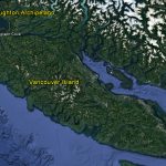
Broughton Archipelago
The Broughton Archipelago

In August 2016, KJ and I spent 10 days paddling our Clipper Tripper Kevlar canoe from Telegraph Cove on Vancouver Island, BC through the Broughton Archipelago.

Watch the video or scroll down to read the story.
At Telegraph Cove, early on our first morning, we checked in with a guide company with our intended return date as a safety measure, loaded the canoe and headed out, paddling east along the shore of Johnstone Strait for a few kilometres. Before crossing the strait to Hanson Island, we used our VHF radio to call Marine Traffic Services to check for vessel traffic. Then, after getting the all clear, we crossed easily and continued east along the shore until we reached pretty Little Hanson Island where we camped.
Early the next morning, we crossed Blackney Passage in a very thick fog at slack tide without incident using compass bearings we had taken the previous evening.
Continuing on, we paddled in calm waters through Indian Channel to Village Island where we (mostly I) got a little confused by the myriad islands. We did figure it out, eventually, and continued on past Crease Island to a camp on Owl Island.
On the third morning, we waited for another heavy fog to lift before setting out to Bonwick Island by way of Seabreeze Island. Continuing along the west side of Bonwick through a maze of tiny islands, we crossed Arrow Passage then up Spiller Passage, ending our long day at Insect Island.
The camp at Insect is way above the water and given the expected high tide, we decided to carry our canoe 50 vertical feet up the steep path to the lovely campsite.
The next day, we felt confident with the weather forecast we heard on our VHF radio, so we made our way along Fife and Hornet Passages to the Burdwood Group. There, we camped on a small island in whose sheltered bay were moored several boats. Though the weather was cool and skies were cloudy, we enjoyed relaxing on the beautiful white clamshell midden beach. That midden indicates the long history of First Nations’ use of the land and sea.
Since leaving Hanson, we had not seen any big marine life, but the area was still beautiful, though we did pass several fish farms. (Please don’t eat Atlantic salmon—this is where they are grown and they endanger wild Pacific salmon stocks).
Heading south to the put in, we stopped at Pierre’s near Echo Bay to stock up on water and camped on one of the islands in the Fox Group. We were lucky to find a small spot for our tent, because all the other tent sites were being used by a large commercial group.
The following day, we headed south along the east side of Bonwick to the Sedge Islands, then crossed Spring Passage to Fire Island SW of Cedar Island and crossed to isolated Whitecliffs Island under blue skies and calm water.
At the island, the carry to get our gear and canoe above the high tide line was hard, but at least we landed at high tide, which made the landing easy. Another commercial group arrived just after us, but we had time to get a stunning tent site overlooking broad George Passage and distant Queen Charlotte Sound. All evening we delighted in watching and listening to humpback whales and seeing a few curious sea lions.
Loading and getting into the canoe the next morning at low tide was very difficult, as we don’t like to scratch our canoe. So, to keep the canoe off the jagged mussels and rocks, we placed the canoe in a tiny bay with one end suspended on a long log spanning the bay and the other in the water. As I was placing gear into the boat, I got knocked by a wave and brushed my leg against the rough wall lining that tiny bay. The deep scratches on my leg took weeks to heal.
Once we were on the water, we headed towards Swanson Island, where we found ourselves enveloped in a thick fog. As we paddled, we heard the sound of a humpback nearby, so we stopped to listen, hoping to catch a glimpse. We never saw it, but we enjoyed just listening to it breath. On we went, following the SW side of Swanson in Blackfish Sound to a small point across Flower Island. By that time, the fog had lifted, and we spent several hours relaxing on the beach under the bright sun in a gentle warm breeze.
The winds stayed calm, so we decided to carry on and cross Blackfish Sound. I called Marine Traffic Services to ask about incoming vessels and the operator told me that a cruise ship was due imminently. Just then, I looked up and saw a huge, really huge, cruise ship crossing our intended path. Man, those things move fast and are surprisingly quiet.
When the coast was clear, literally, we zoomed across the sound, then headed west on Hanson’s north side. The many deep bays lining that coast made it quite difficult to figure out which was the passage before the Plumper Islands. After what seemed to be an interminable time, we found the passage and were lucky that the tide pushed us along at a rapid but safe rate.
The SW tip of the island has a campsite, but it was already full with a commercial group. A few kilometres east, we found an empty commercial site with a well designed kitchen, toilet and tent sites. We made it home for two nights.
From our beach, we watched orcas pass by in Johnstone Strait and saw the spouts from humpbacks just a kilometre away.
The marine life around Hanson is amazing, as the strong currents stir up plenty of nourishment. So, though we were only a few kilometres from Telegraph Cove, we decided to spend our penultimate day paddling along the shore to enjoy the sights. As we paddled along, we stopped often to gaze at the colourful plants and animals just beneath the water’s surface. I even snagged a prize floating by the shore–a six pack of my favourite drink, diet Coke.
We lunched on Little Hanson and through binoculars watched a pod of orcas hunting in the turbulent water off Cracroft Point, surrounded by whale watching boats. We also marveled at the very fast current in Blackney Passage. We were happy that we had timed our crossing so well eight days earlier.
Soon, it was time to head back to our camp, and as we began paddling, we noticed the orcas heading our way. We moved out into the strait beside about a dozen guided kayakers and then delighted as the orcas passed right by us.
By then, a headwind had risen and so, we followed within feet of shore to take advantage of every lee. We even managed to keep up to the orcas in the middle of the strait.
Finally, arriving back at camp, we ate our last meal, took some bearings to the mainland in case the morning was foggy and went to bed early. As I tried to fall asleep, still buzzing from our amazing encounter with the orcas, I heard the telltale sound of a nearby humpback. I crept down to the water’s edge to listen and perhaps spot it. After half an hour of listening, I went back to bed, but the noisy animal kept me up for a long time. Pretty cool way to be kept awake.
While the next morning was clear, the skies were dark and waves lined the strait. We didn’t see whitecaps, which mark the limit of our canoeing comfort, so we put the skirt on the canoe, checked in with Marine Traffic Services to make sure no ships would be travelling down the strait and headed out.
The crossing was a bit challenging, but within our limit, and soon we were across. For a final reward, we sighted a couple of Dall porpoises before turning into Telegraph Cove to end our ten-day, 160 km adventure.
The Rhythms and Awe of Nature
The Rhythms and Awe of Nature, by KJ

If you live near the ocean, think for a moment what time the high and low tides will be tomorrow. Wherever you live, can you tell me where the moon is in its cycle? Do you know (without Google) the exact time the sun will rise and set tomorrow? What direction and speed were the winds today? If you’re like me, in my normal urban life, I can at best approximate those events. On this trip on the ocean in our canoe, those rhythms of nature became part of our daily awareness and experience.
One way we lived in that rhythm was that we planned our trip around the southerly tidal ebbs and northerly flooding tides, so that, for the most part, we could get a gentle push from (rather than fight) the tidal currents. What we couldn’t arrange with Mother Nature was to always arrive at and depart from our campsites at high tide. As we paddled south, we left at high tide to follow the ebbing tide, but that meant getting to camp at low tide. As we canoed back north, the opposite was true.
This presented some challenges for us as we had some long carries of our gear and canoe up or down rocky beaches to our campsites.

Also, wherever we camped, we needed to be sure we were above the high-tide line if we didn’t want to wake up swimming in our tent.

We also followed the sun’s daily cycle. For the most part, we got up when it got light, about 5:30 or 6 a.m., and went to bed when it got dark, about 9:30 or 10 p.m. This rhythm worked well with our daily routine of paddling early in the morning to avoid afternoon winds, lounging in or exploring our magical campsite areas in the afternoon, taking time to cook wonderful meals in the early evening, and going to sleep soon after sunset following our full, eventful and sensory-rich days in nature.
Being in nature for 12 days has also helped me understand better why animal, bird and fish symbols are so important to First Peoples. I’ll never forget that morning on North Beach on Calvert Island when a curious seal stared at me from the water as I stood on the shore wondering how we would launch our canoe into the crashing waves. I imagined the seal was telling me all would be well, and I actually felt myself relaxing as I envisioned his natural ease and grace navigating the turbulent ocean waters.
One morning, we came upon a raft of napping sea otters floating on their backs, feet pointing in the air like guests relaxing on pool floats at a resort.


Another time, on one of our walks, we saw sandlings feeding on the wet shore and playfully riding the sun-kissed waves as they washed up on shore.


From the canoe, we watched an eagle deftly swooping down to catch a fish and saw many sea gulls atop drifting logs as if they were ‘paddle birding’ or simply found them and hawks roosting in nearby trees.


We were amazed every day watching salmon jumping high out of the water like Olympic high-jumpers going for gold. For the whole trip, we felt in awe of the wonders of the animal world.
Now that we’re back home and already busy with city and work life, I miss the very direct and daily connection to the animals and to the elements of nature: tides, sun, moon, winds and waves. I’ll always value those special times and try to remember to pay more attention to the beautiful rhythms of nature.
It’s a Tough Life
It’s a Tough Life
Mom often asks, “When are you going to take a normal holiday?” By that, I think she might mean go to a resort and lie on the beach. Well, that’s what we do. Kinda.
Usually, we’re out of bed at 5:30 or 6 a.m. to paddle our 15-25 daily kilometres and get off the water before the winds rise.

While KJ puts away the kitchen, arranges food for lunch and prepares breakfast (tea and bagels with cheese for her and PBJ and a cup of milk from powdered milk for me), I take down the tent, stuff the sleeping bag (we share a double) and compress the thermarest sleeping pads. Then, after a quick breakfast, we carry the gear and canoe down to the water, load the canoe and by 7 a.m., we’re paddling. By noon, or 1 p.m. at the latest, we’re at the new camp.
Then comes the resort part of the day. Nap, read, explore, sit on the beach, collect sea shells, look at intertidal life, go for a walk, rinse and repeat.


As the day comes to a close, we prepare dinner. Kitchens are interesting places.

BTW, we don’t do the dehydrated stuff. It’s not Downton Abbey, but it is fairly elaborate because we enjoy the process and the delight in eating good home-cooked food. We bring fresh frozen fish and bagged salad for the first night and for almost every dinner, we have sautéed vegetables and brown minute rice or quick cooking pasta or gnocchi with sauce. Other staples include fried tofu, canned salmon or tuna and even falafel. Dessert consists of a bar of dark chocolate or canned fruit.

The dining rooms are always splendid.

By 9:30 or 10 p.m., we’re in our cozy bed, in our comfy tent, ready for another day.
So, as you see, camping is just like being at a resort except there’s no room service.
“Dude, Take My Car”
“Dude, Take My Car”
Upon our return to McLoughlin Bay, the ferry terminal outside of Bella Bella, home to 1,400 Heiltsuk people, we had a six-hour wait before the ferry departed. While the tiny waiting room offered free tea and coffee, after 12 days of going without, I wanted a diet coke and chips. As Bella Bella is only accessible by water (or air), and because we were able to launch our canoe right beside where the ferry docked, we had left the car at the ferry terminal in Port Hardy, a town at the northern tip of Vancouver Island. So, I casually asked a staff member how long it would take to walk to town. His answer was stunning. “Dude, just take my car.” And that’s how I got my pop and chips.

Go back to the list of stories
Surf and Turf
Surf and Turf
For most of the night, I laid awake in the tent with my eyes wide open listening to the surf crash on the beach, my mind racing with thoughts of how we were going to launch the canoe in the morning into those waves. Earlier that day, after an adventurous ride down Kilditt Sound and a misty 5 km crossing of notorious Hakai Passage, we surfed onto the expansive and sandy North Beach on Calvert Island on a smallish two-foot high wave.
After landing, we both jumped out and dragged the canoe up a few feet before the next wave swamped it.
We had arrived in the place I had dreamed of—a kilometre-long sandy (albeit log strewn) beach, not far from where researchers had recently discovered 12,000-year-old human footprints.

After setting up camp on the beach above the high tide mark, we followed trails to the wild and exposed West Beach under a haze-obscured sun.

We also visited the Hakai Research Institute in Pruth Bay, which houses as many as 70 researchers and staff.
The next day’s launch was going to be unusual. Usually, when we leave a campsite, we carry our gear down to the beach, then carry the canoe down and place it in the water, wade into the water with the gear, load the canoe, climb in and set off. Easy. On North Beach, that wasn’t an option, as the waves were breaking right on the shore. It was time for a more creative but risky solution.
Just after dawn, as the tide started to come in, we carried our gear and canoe down to the beach as usual, but this time we laid the canoe atop a series of logs and loaded the canoe onshore. The next step involved rolling the fully-loaded canoe a few feet forward. Then, we placed one log after another in front of the bow, rolling the canoe forward again and again until the logs were submerged but still holding the weight of the canoe. Finally, KJ got in the bow seat, while I stood behind the canoe waiting for a big wave to come. A few moments later, a big wave did come followed by its wash that came up under the canoe, lifting it slightly. Quickly, I pushed the canoe forward into the water and jumped in awkwardly as the canoe was moving hoping for a brief pause before the next wave broke. The canoe tilted wildly to one side as KJ braced and I yelled “Paddle!”. Within a moment, we were out beyond the break. Phew, we made it!
The photograph below belies the excitement of launching the canoe in the surf.

The Joy of Remoteness
The Joy of Remoteness

KJ and I spend a lot of time paddling in Indian Arm, a 25-km-long fjord in North Vancouver. Though much of it is lined with homes, some accessible by water only, we enjoy paddling along it, but rue the plethora of motor boats and their wakes and loud music, the yachts and the thumping sound from their diesel engines that can resound for many kilometres, and even worse, whiny seadoos. To avoid that, we avoid summer weekends and paddle early in the morning during the week.
Though nowhere we’ve been is as congested as Indian Arm, we have still seen many boats and people everywhere we’ve paddled. Even in the absence of boats and homes, human presence is often marked by the scars of logging clearcuts on surrounding mountainsides.
The Inside Passage was a welcome relief. We were alone at four campsites and spent much of two other days all alone. In 12 days, we only saw two buildings, both on Calvert Island (Hakai Fishing Lodge and Hakai Research Institute), very few boats, no ships or barges, no roads, not a single kayaker on the water while we were paddling and not a single clearcut.

To some, not seeing or being around people for a few days is discomforting. To me, being in a place seemingly untouched by humans makes the smallest creature or tiniest grain of sand appear bigger and more significant than the tallest skyscraper, and a breath of wind in the trees sounds more impressive than a thousand honking car horns. Remoteness reminds me of my place on Earth and the awesome power of nature.
Those are the joys of wilderness.


You Could See Japan from Here if the World was Flat
You Could See Japan from Here if the World was Flat
Looking out from a high vantage point atop a rocky promontory, I could see a little ways north towards Superstition Point, an exposed point of land we had to get around to reach protected Cultus Sound and then, in two days, the ferry, 30 km further north.

Days earlier, we had passed that point without much problem on our way south, but now, paddling north, conditions had changed. To the west lay seemingly endless ocean and swells.
Though we left Triquet Island, 12 km away, early that morning, we encountered a forecasted headwind. That was fine in the quiet channels we paddled through, but as we approached Superstition Point, the wind, waves and swells overwhelmed us. Kayakers revel in those conditions, even seek them out, but they’re not to our taste. We can handle round, slow moving 2-metre swells, but these were larger, and there were also big waves ahead that had the potential to break over our bow.
To avoid calamity, we headed into the large and complex Swordfish Bay to find a campsite someone briefly mentioned a few days earlier. It was not among any I had read about. After scouring all the tiny coves and arms, we found it, a wind protected tidal flat with a sandy section above the high tide mark. Perfect. Even better, according to the forecast, the winds would abate at midnight.
We had all day to relax


Our alarm clock buzzed before dawn, and within an hour, we were on the water, passing the exposed point in much calmer conditions.

Soon, we were in the glassy waters of Cultus Sound.

As I looked west, I thought that if the Earth was flat, we would see Japan, but all we saw was water because y’know, the Earth’s a globe.
Ignoring the Obvious
Ignoring the Obvious
Day three’s destination was Isle 55 in the Prince Group. Looking at the map below, you might say, “Sure, that’s easy.”

But on the water, large and small islands are hard to tell apart. Also, campsites are not always obvious. Often, the campsites are upland in the forest, hidden from view until you’re literally standing in one, unless people are there.
Even though the GPS took us to the islet, we couldn’t be sure where the campsite was, as we couldn’t see it from the water, and there was not a boat or kayaker around for miles. KJ disembarked a couple of times and scrambled over low-tide exposed rocks to look for a campsite, each time finding nothing. At times, we (I, Jeff) doubted whether we were even at the islet.
Did I mention that there was a black buoy in one of the bays? Twice we entered that bay and left because the landing looked impossible. In all, we circled the island, and a few others, three times. We had time on our side—it was only 11 a.m. We’d find it. In the end, as the tide came in a little, covering the rocky shore, the bay started to look like a possibility.


Of course it was where the campsite was. Did I mention the buoy?